Thermal Game Count

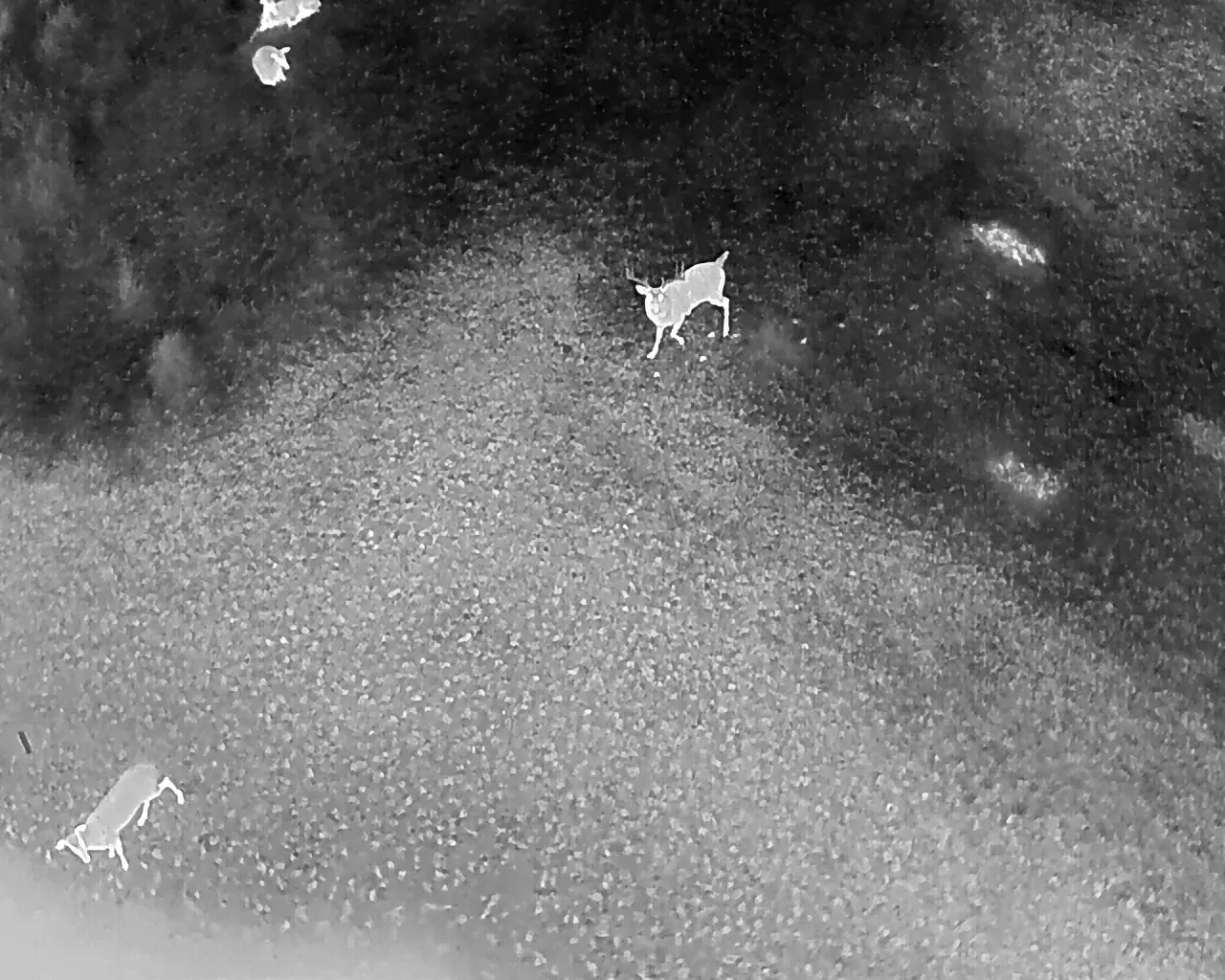


Drone-mounted advanced thermal optics help provide insights into your animal populations like never before. Our high-resolution thermal imaging cameras are capable of detecting bedded or camouflaged animals that would otherwise remain invisible to the human eye. Whether you’re managing a hunting lease, informing your wildlife management activities, or evaluating herd health, our aerial thermal survey services provide precise and actionable data.
Detailed heat signature outlines allow our experienced team to differentiate bucks vs. does, fawns vs. mature animals, and even distinguish multiple species using thermal imaging alone. This non-invasive and highly efficient method outperforms traditional wildlife survey techniques, especially in thick cover.
Our drones follow a pre-planned, GPS-guided flight route to ensure 100% of your property is covered, delivering comprehensive aerial wildlife population data.
Following the flight, you will receive a detailed final report that includes both the initial and reviewed animal count, flight details, a map of the drone flight path, and 3–5 high-resolution thermal images highlighting notable bucks or unique animal activity. This report can be sent directly regional biologists to fulfill Texas Parks and Wildlife (TPWD) Managed Land Deer (MLD) Program survey requirements. It can also be provided to county appraisal districts as part of a 1-D-1 wildlife exemption.
For added value and transparency, we also record the entire flight and mail you a physical SD card containing the full video footage. This allows you to review the data at your own pace, share it with other lease members, or provide it to biologists or land managers for further analysis.
Our thermal drone wildlife survey services are ideal for landowners, lease members, and hunters looking to make informed wildlife management decisions based on accurate and up-to-date wildlife counts. View an example of this final report below:

